 Status
Status: Article Under review at Annals of GIS since 09/2025
Overview
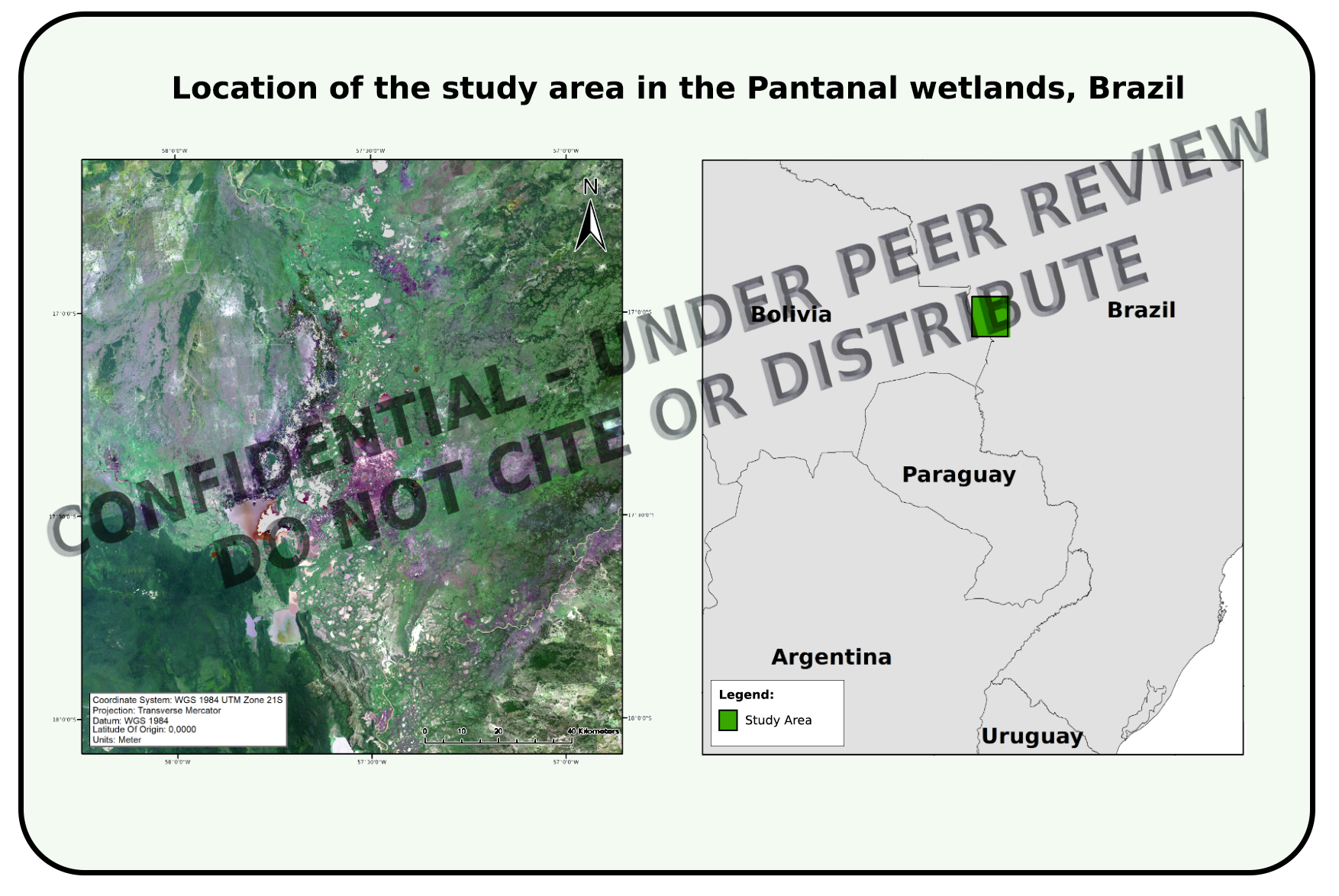
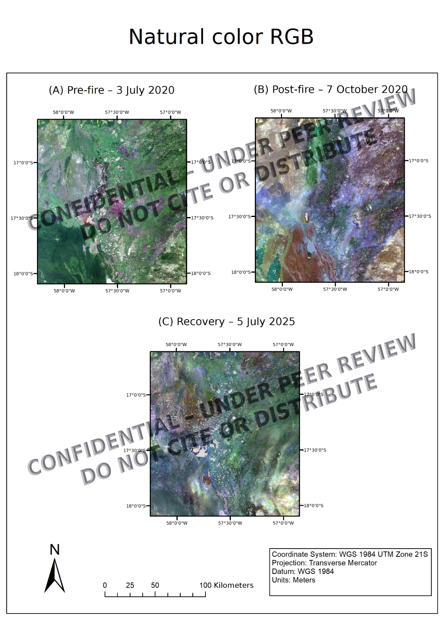
The Pantanal, one of the world’s largest tropical wetlands, has faced escalating wildfire severity in recent years. We used Landsat imagery and spectral indices (NBR, dNBR) to assess the 2020 fire season’s impact and track vegetation recovery through 2025. This reproducible, cost-free workflow supports fire management, ecological restoration, and governance in under-resourced regions. Spatial outputs reveal varied fire severity and recovery across savannas, floodplain forests, and grasslands, underscoring biome-specific restoration needs.
Key-words
Pantanal wetlands, fire ecology, burn severity, dNBR, vegetation recovery, Landsat, open-source remote sensing, ecological restoration
Methodology Highlights
Landsat 8 Surface Reflectance (Level-2) data from 2020 and 2025
Pre-fire, post-fire, and 5-year recovery time points
Spectral indices:
Normalized Burn Ratio (NBR)
Delta NBR (dNBR) for fire impact and regrowth
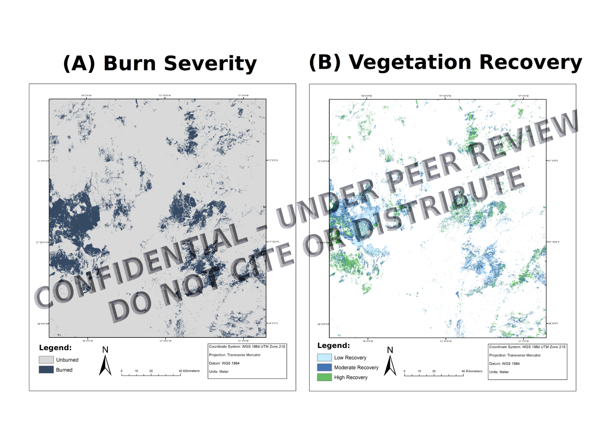
Classification of burn severity and vegetation recovery based on dNBR thresholds
Visual composites (RGB) and cartographic outputs processed with open-source tools
Key Results
2,736 km² (11.8%) of the 23,225 km² study area classified as burned in 2020
Recovery within burned zones (2025):
28.4% not recovered
38.5% partially recovered
33.1% fully recovered
Floodplain forests showed the fastest regrowth; open grasslands and savannas lagged
Recovery patterns spatially clustered, revealing strong biome-dependent dynamics
Outputs compatible with restoration planning and spatial zoning instruments
Environmental Relevance
We present the first reproducible, fully open-access fire assessment workflow applied to the Pantanal wetlands. Our findings offer actionable spatial data to align fire response with Brazil’s PNMCIF, Forest Code, and zoning policies. The method is transferable to fire-prone wetlands and tropical savannas worldwide. The results reinforce the need for biome-specific strategies in fire resilience and restoration.


