 Status
Status: Under review at Arctic, Antarctic, and Alpine Research since 06/2025
Overview
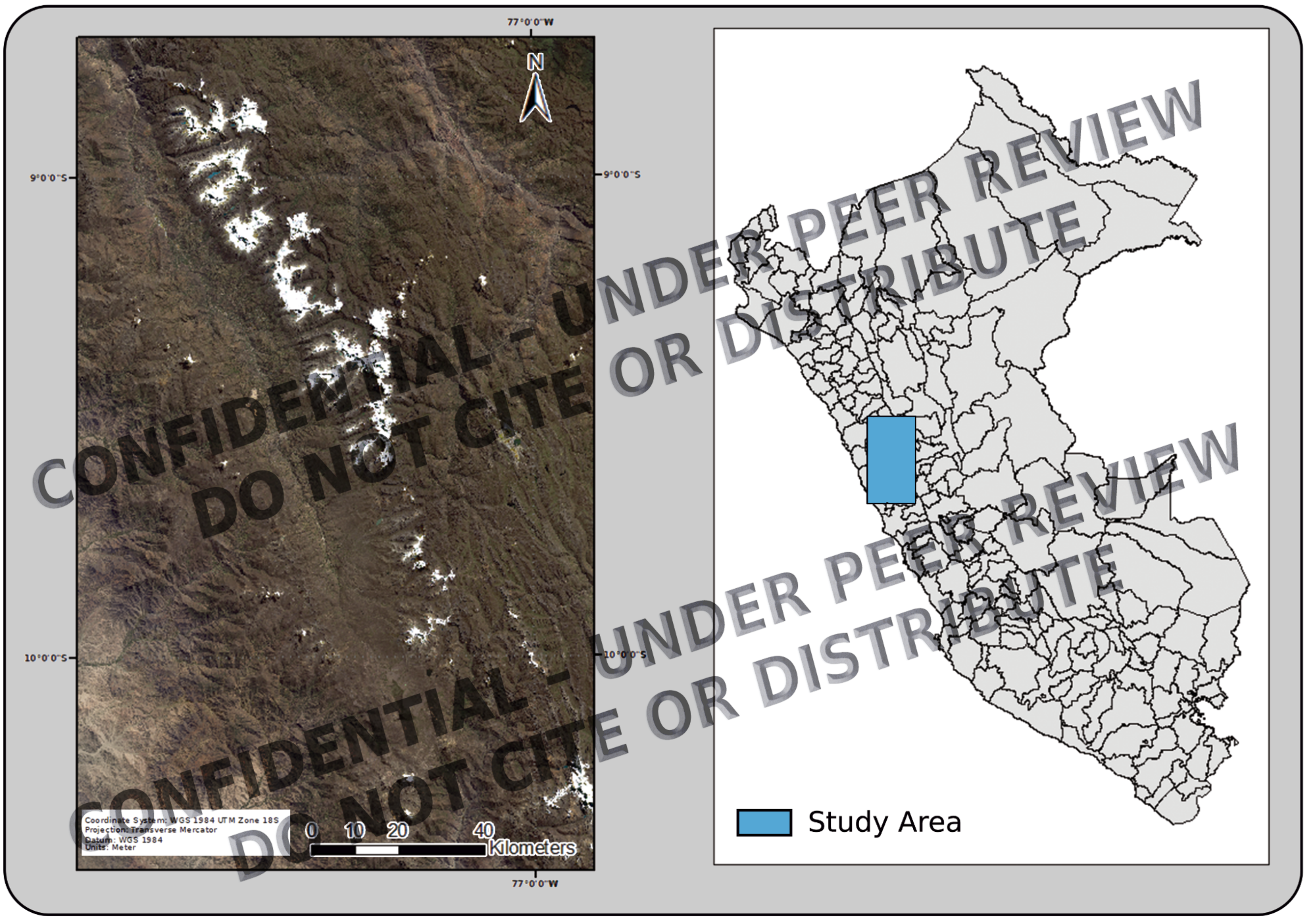
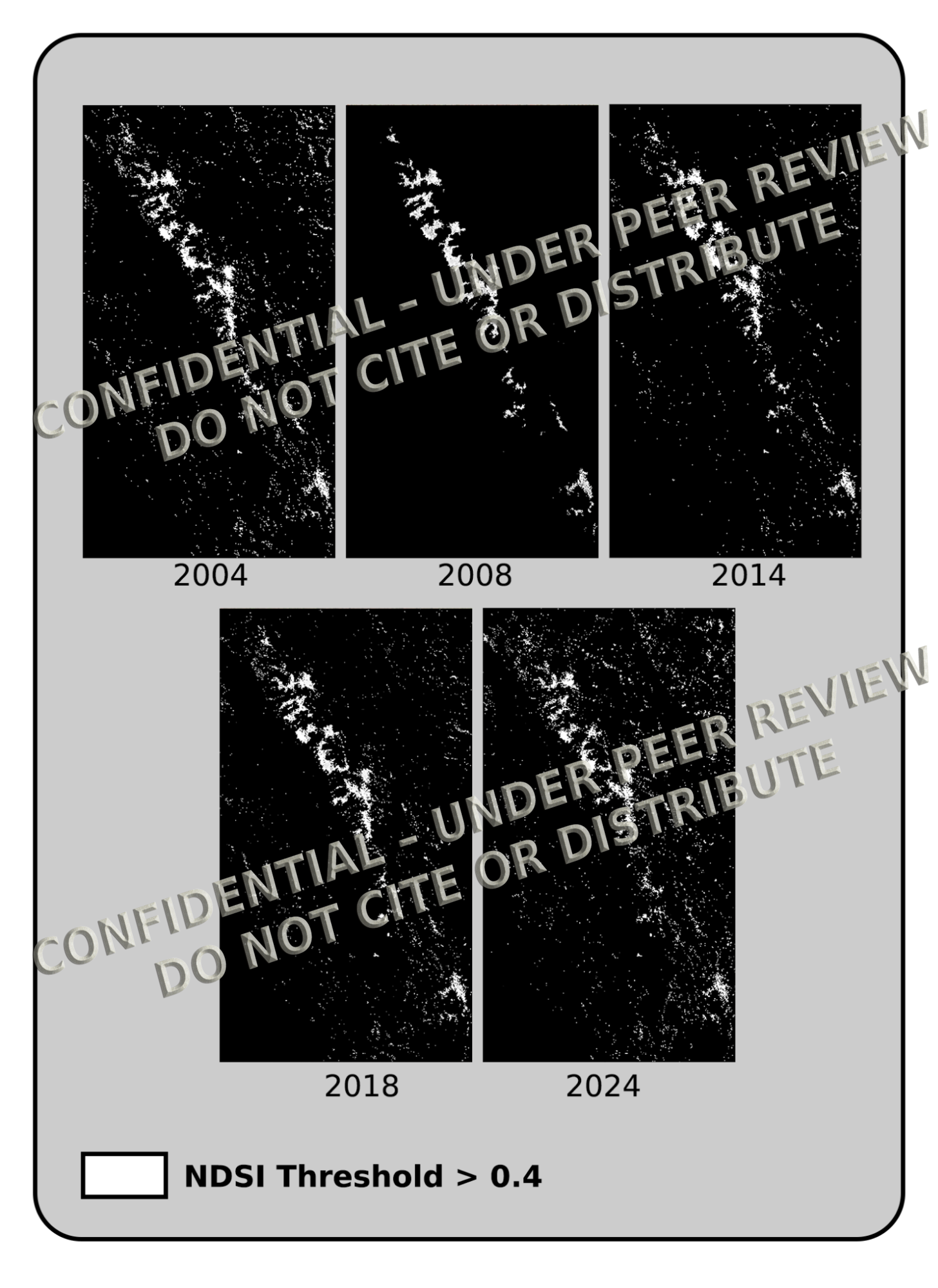
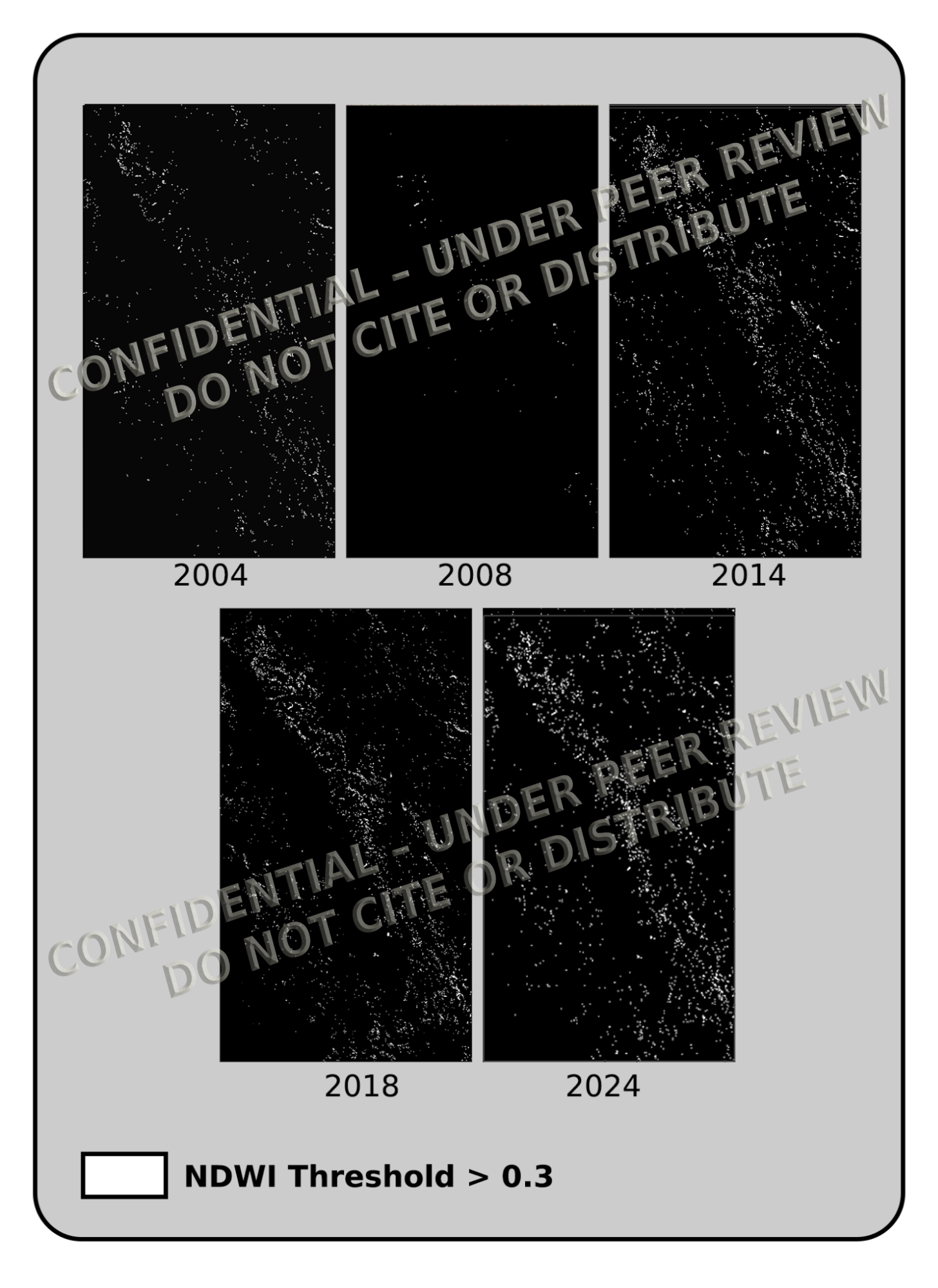
Tropical Andean glaciers are vital for regional water supply but have received limited long-term remote sensing analysis. We analyzed 20 years (2004–2024) of Landsat data to track annual snow and surface water dynamics in Peru’s Cordillera Blanca. NDSI and NDWI indices, combined with 30 m DEMs, captured both horizontal and vertical variability. Instead of linear retreat, glaciers showed oscillating trends, declining in 2009 and 2019, with partial recoveries by 2024. Fixed-point snowline tracking revealed ±7.5 m vertical shifts, indicating elevation-sensitive climate response. The workflow relies entirely on open-access data and reproducible methods, offering a scalable framework for cryosphere monitoring in tropical mountain regions.
Key-words
Cordillera Blanca, tropical glaciers, Landsat, snowline elevation, NDWI, NDSI, cryosphere monitoring, altitudinal analysis
Methodology Highlights
Landsat-based NDSI and NDWI classification (thresholds: 0.4 and 0.3)
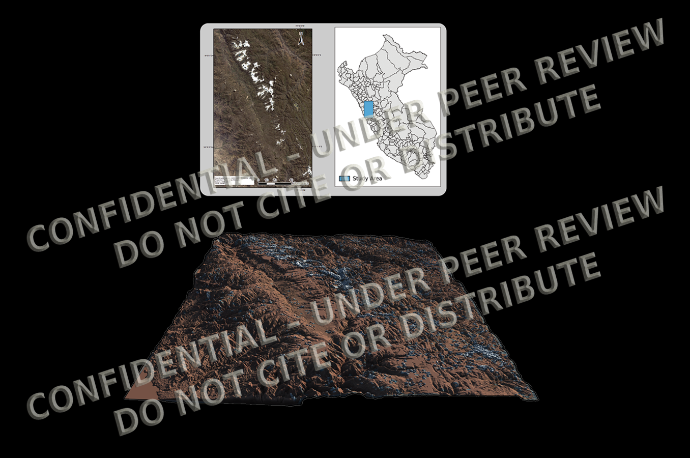
DEM projection of classified rasters for 3D spatial insight
Year-by-year analysis across two decades (2004–2024)
Fixed-point snowline elevation tracking (−9.0026°, −77.5915°)
Terrain-projected maps with vertical exaggeration
3D visualizations of cryospheric change over time
Key Results
Identified strong interannual fluctuations with no monotonic trend
Sharp cryospheric declines in 2009 and 2019; partial recoveries in 2014 and 2024
Snowline shifted ±7.5 m in elevation, reflecting short-term climate variability
Water coverage dropped to near-zero in 2019–2023, rebounding in 2024
All results supported by DEM-projected classification masks
Environmental Relevance
The Cordillera Blanca contains the planet’s largest tropical glacier system. Our findings suggest that glacier- and snow-fed water sources can show short-term resilience, but remain vulnerable to episodic climate-driven losses. This approach informs water security planning, glacial hazard assessment (e.g., GLOFs), and long-term cryosphere monitoring in data-scarce mountain regions. Including elevation data clarifies how snowlines respond to variable climate forcing.


