 Status
Status: Main article accepted for publication in Geo-spatial Information Science (2025) DOI: https://doi.org/10.1007/978-3-031-97763-3_2
Second article published in Lecture Notes in Computer Science (LNCS) (2025) DOI: https://doi.org/10.1007/978-3-031-97763-3_2
Third article published in Lecture Notes of the Institute for Computer Sciences (2024) DOI: 10.1007/978-3-031-55312-7_7
Overview
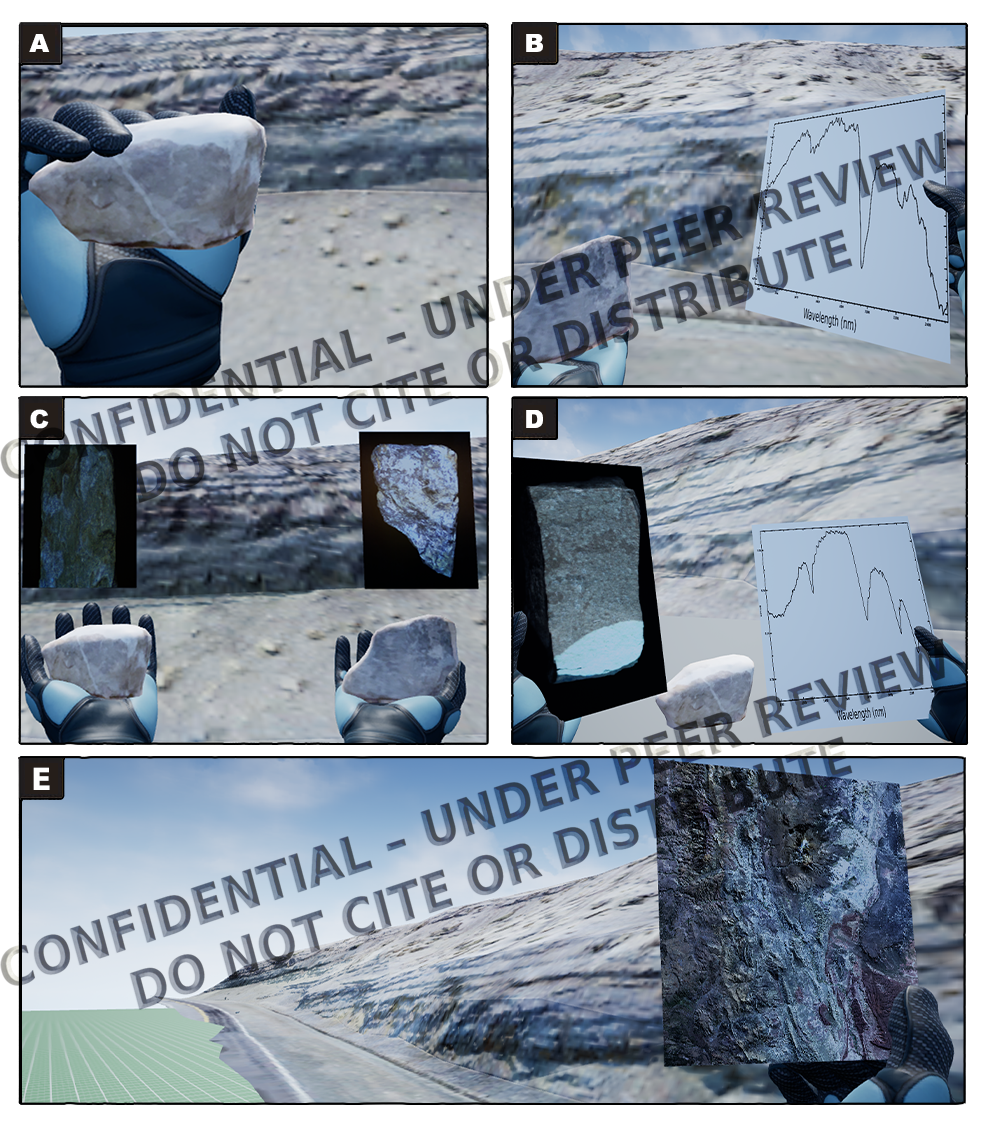
Digital interpretation of fine-grained sedimentary rocks is challenging due to low visual contrast and overlapping mineral signatures. To enhance interpretive resolution through multiscale observation, we developed a cyber-physical modeling workflow that integrates UAV photogrammetry, close-range LiDAR, and VNIR–SWIR hyperspectral imaging. In the Vaca Muerta Formation, the system generates an integrated 3D platform for real-time exploration of stratigraphic and mineralogical variation. An SQL-based architecture links spectral, structural, and spatial data to support reproducible geological interpretation. Compared to hand specimen analysis, the workflow matched classification accuracy (χ² = 0.167, p = 0.68) while improving spatial insight. The platform supports virtual reality deployment and advances digital twin development in geosciences.
Keywords
Multisensor integration, 3D outcrop modeling, hyperspectral imaging, Vaca Muerta, VR-based geological analysis, stratigraphic modeling
Methodology Highlights
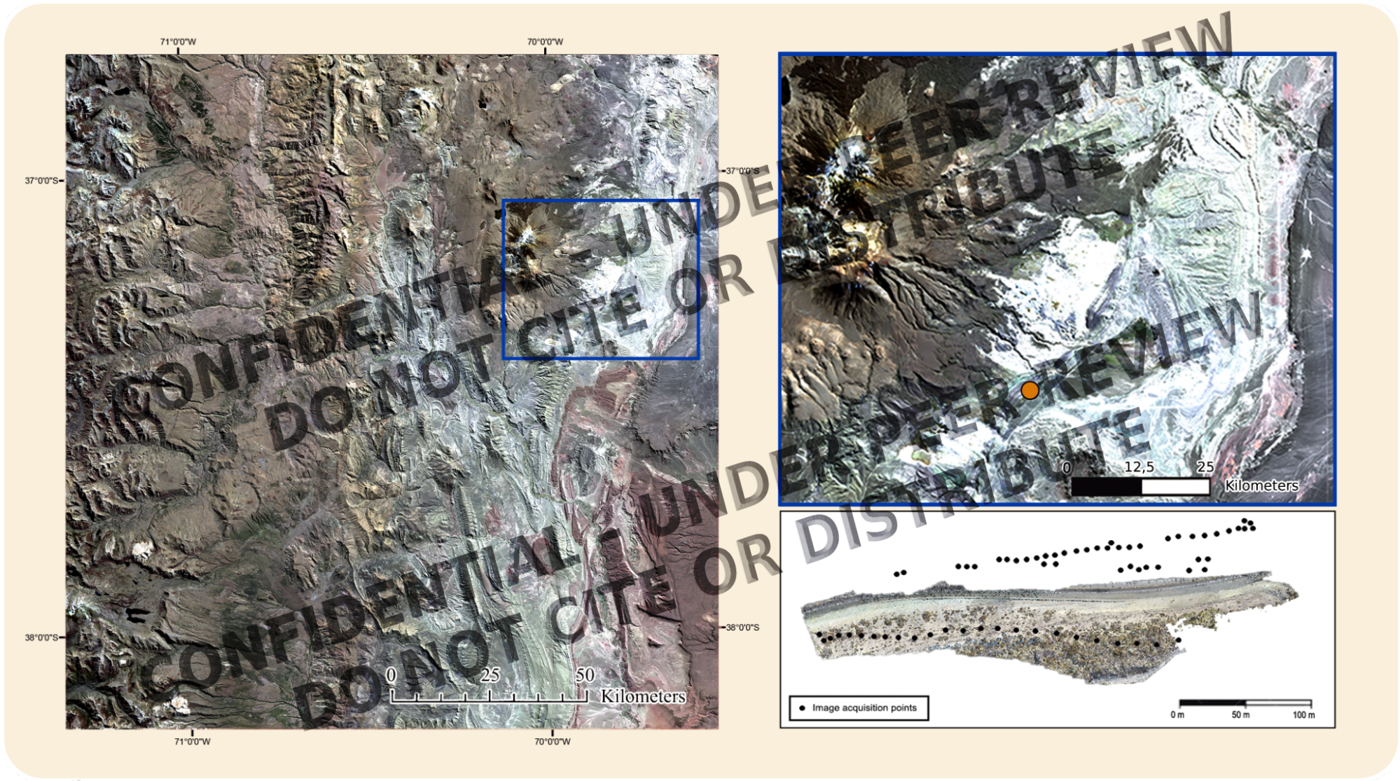
UAV photogrammetry for Digital Outcrop Models (~2–5 cm GSD)
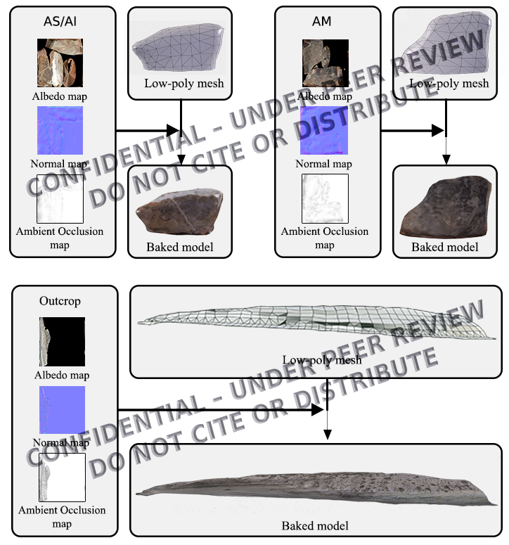
LiDAR scans of hand samples using iPhone 16 Pro
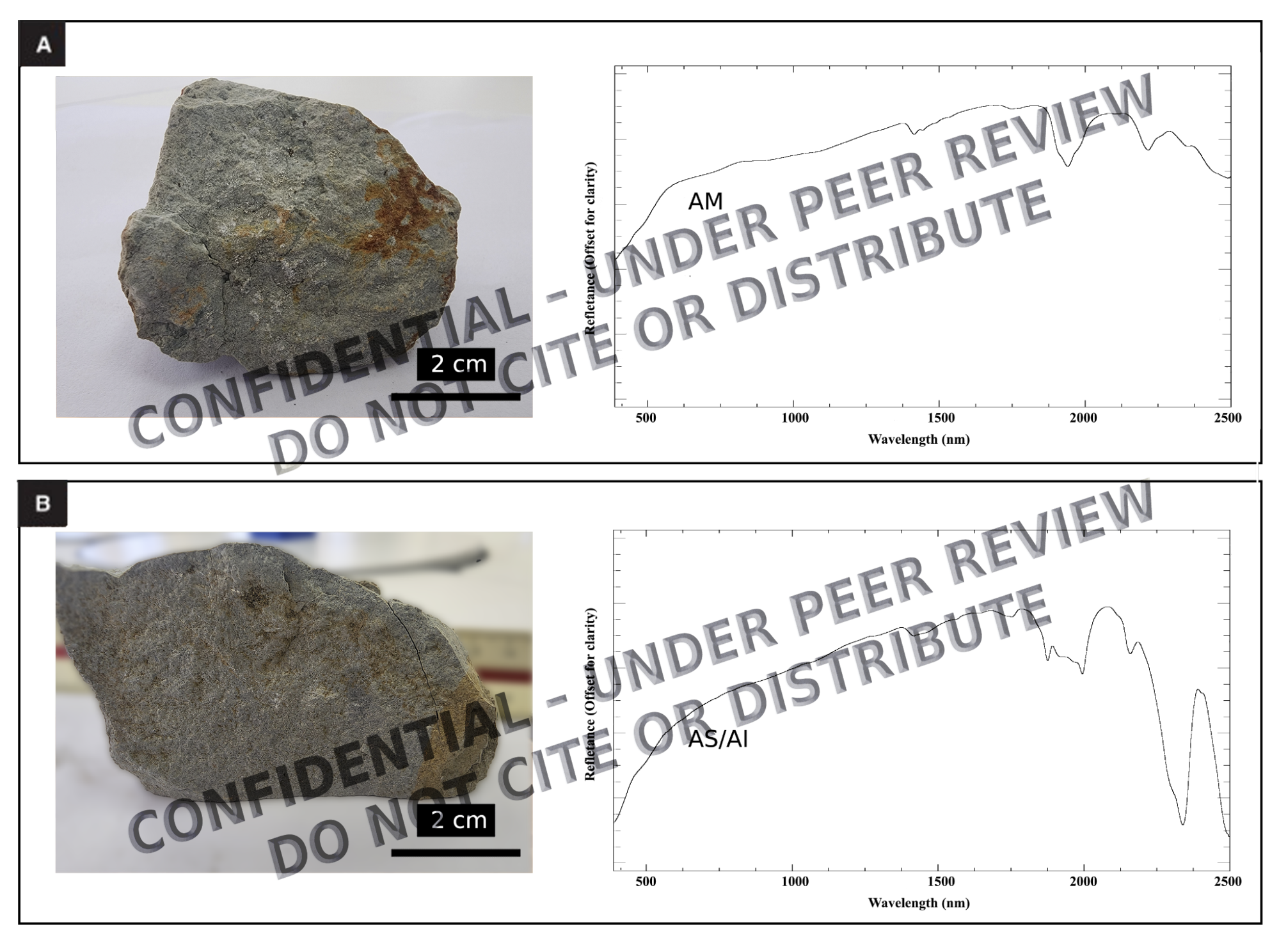
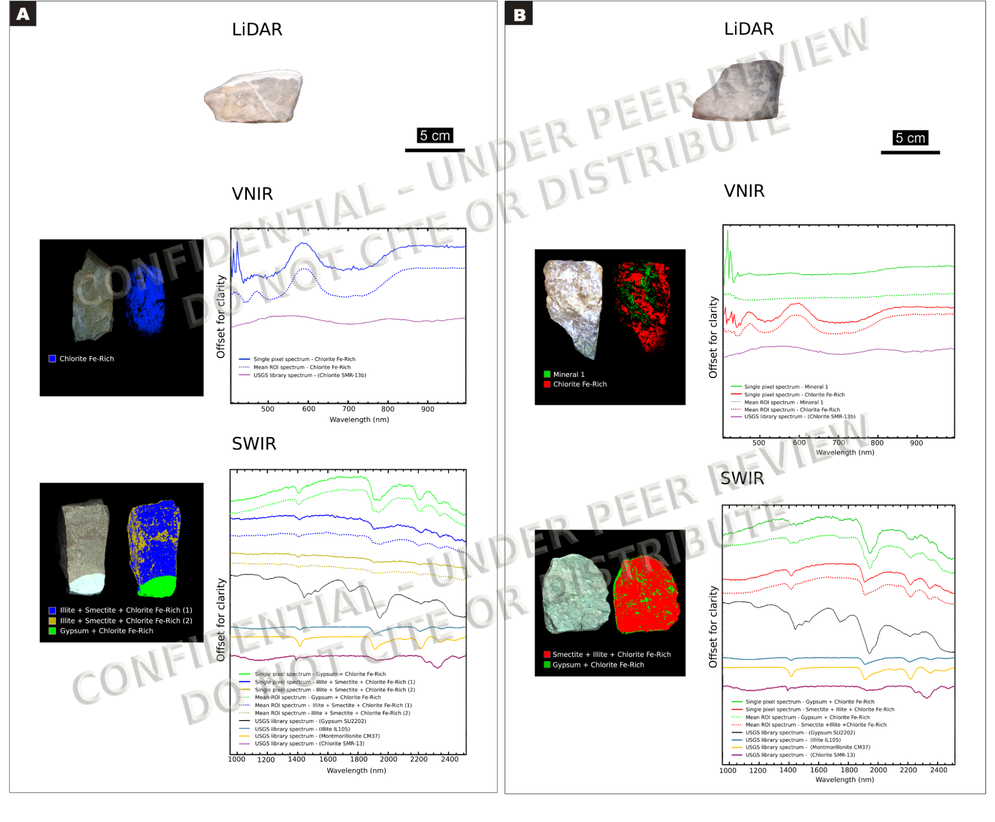
Hyperspectral imaging (VNIR-SWIR) with HySpex sensors
Data processed in ENVI + Metashape + Unreal Engine 5
Relational SQL database for semantic geospatial integration
Platform supports real-time spectral inspection and structural navigation
Key Results
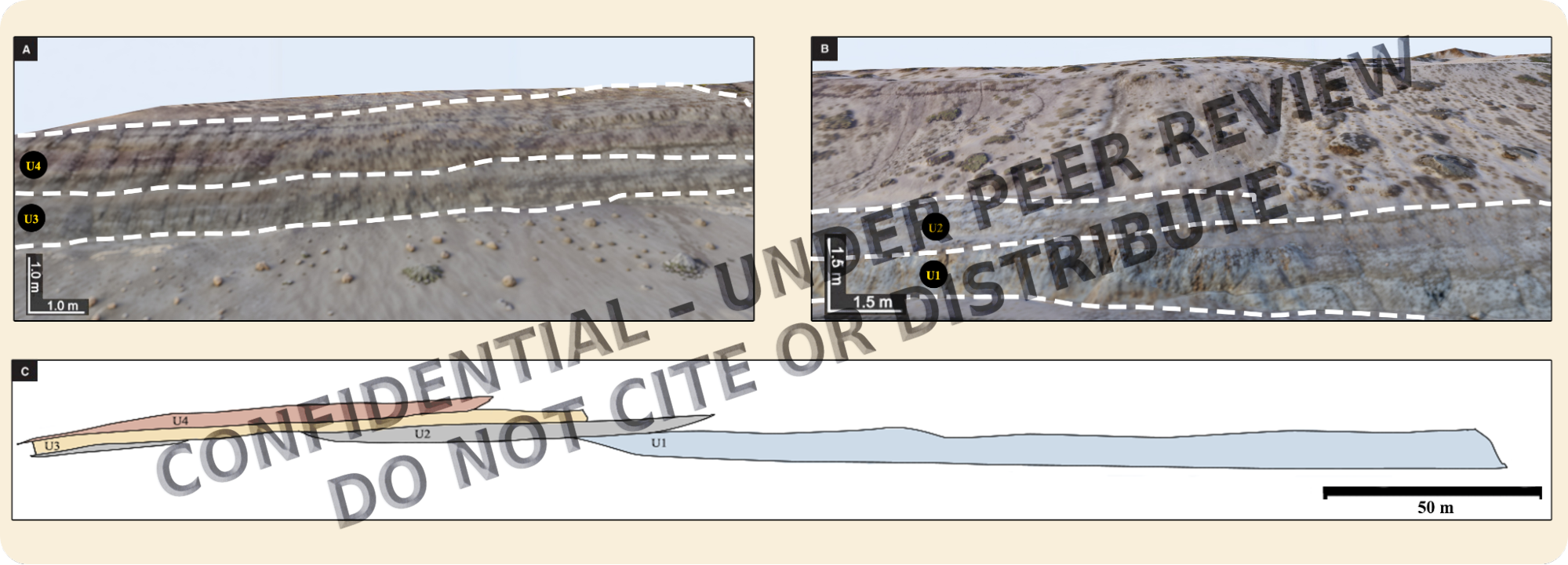
Identified 4 stratigraphic units (U1–U4) not detectable by single-sensor methods
Mapped vertical zonation of clay minerals (illite, smectite, gypsum)
Achieved spectral classification accuracy statistically equivalent to hand sample analysis (p = 0.68)
Developed a VR-ready geospatial environment for geological analysis
Geological Relevance
We validated the workflow in the Vaca Muerta Formation, one of the world’s largest unconventional hydrocarbon reservoirs. Its low visual contrast and fine-grained facies make it a challenging testbed, highlighting the integration’s value for reservoir modeling and digital fieldwork.
